
Politics
Maharashtra to Use Satellite, Drone and GIS Technology for Real-Time Monitoring of Tree Plantation
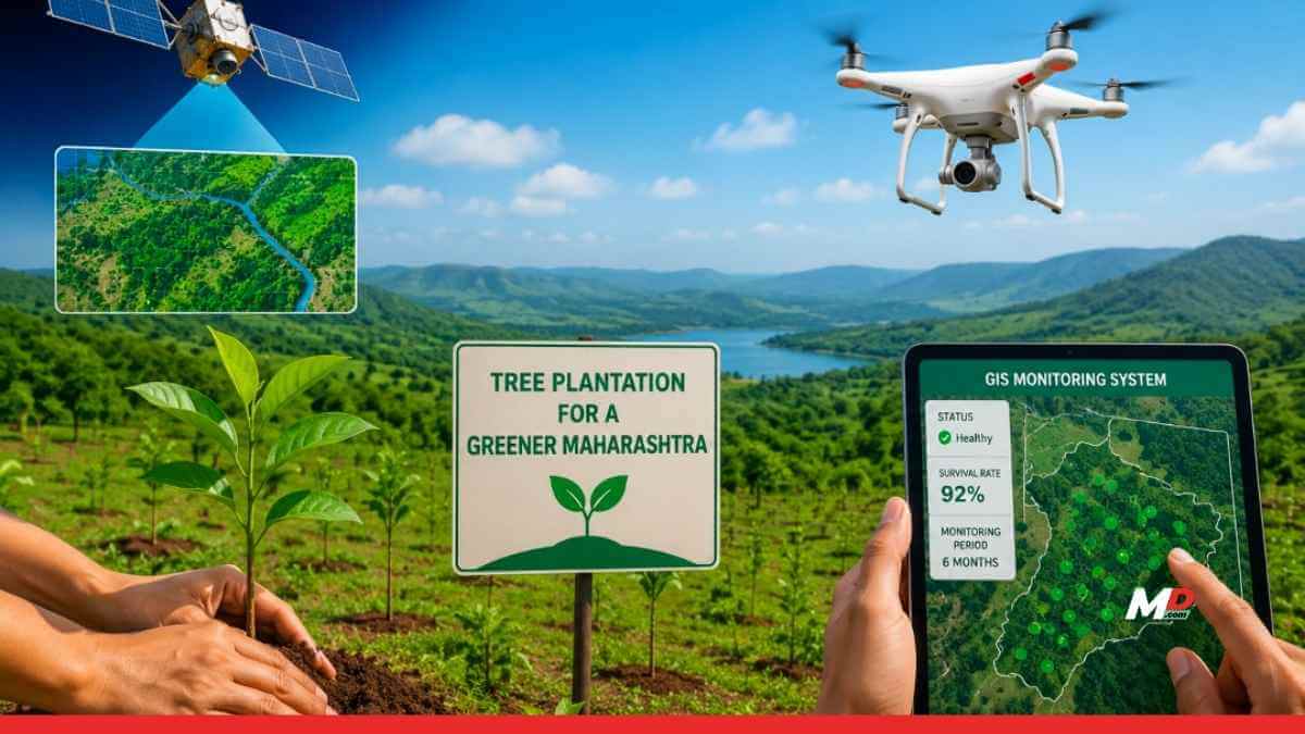
MUMBAI: The Maharashtra government has decided to strengthen its tree plantation drive by introducing real-time monitoring through satellite technology, drones and Geographic Information System (GIS) mapping. During a high-level review meeting, officials said a dedicated monitoring mechanism has been developed to track the survival and growth of planted saplings for up to six months. The required technical infrastructure has been established through the Maharashtra Remote Sensing Application Centre.
The meeting also reviewed the availability of saplings across the state. The Forest Department currently has around 60 million saplings and aims to increase this capacity to 100 million by next year. To achieve the target, the government will expand the participation of private nurseries under the Public-Private Partnership (PPP) model. While private agencies will be encouraged to produce, sell and distribute saplings, the Forest Department will continue to oversee planning, quality control and overall monitoring.
Officials further informed that the Agriculture Department is also contributing significantly to the plantation campaign. Around 1.5 million saplings are being raised in nurseries operated by agricultural universities, while 26.6 million saplings are being produced through accredited private nurseries across the state.